

Our Services . . . .
- Property Surveys
- Subdivision Design and Layout
- ALTA Surveys
- As-Built Surveys
- Topographic Surveys
- Residential Site Plans
- FEMA Elevation Surveys
- NPDES Erosion Control Plans
- Volume Calculations
- Construction Layout Services
- Including services on Georgia and South Carolina DOT projects
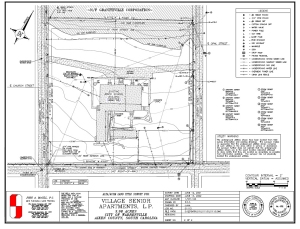 Click the image above for a list of sample drawings.
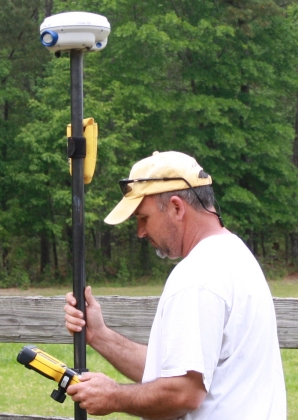
John A. McGill, P.C. is a land surveying firm, providing property surveys, ALTA surveys, as-built surveys, topographic surveys, residential site plans, FEMA elevation certificate surveys, NPDES erosion control plans and monitoring services, model building for machine control, and volume calculations, as well as construction layout services to individuals, developers and construction companies throughout the Greensboro/Lake Oconee area, the Thomson/Augusta area and beyond. We also provide services on Georgia Department of Transportation and South Carolina Department of Transportation projects to various construction companies in Georgia and South Carolina.
In our technical department we utilize Land Desktop, Carlson, and C&G products, all software products commonly and widely used in the engineering and surveying industry. We maintain a subscription to the eGPS Real Time Network for use with our GPS equipment in Georgia and a subscription with SC Real Time Network in SouthCarolina. We also produce TP3 and TN3 terrain modeling files.